The hike to Klakkur is one of the most popular walks in Klaksvík. It is accessible year-round and rewards hikers with some of the best views in the Northern Isles.
The route begins at the parking area below the church in the centre of Klaksvík.
Walk 100–200 metres towards the roundabout. Turn right and continue 25–50 metres to Vágstún. Turn left and follow Uppsalagøta for about 600 metres. Continue onto Nýggivegur. Turn right and walk along Oman Eið for approximately 500 metres until you reach another roundabout.
From there, follow Niðan Horn for about 400 metres. Turn right onto a partly unpaved gravel road known locally as Ástarbreytin (The Love Path).
The gravel road continues up to Hálsur. You can also drive to Hálsur and park there. Please note that the road surface can be uneven.
Although the hiking trail itself is not clearly marked, it is easy to follow. From the outfield gate, walk towards the highest point directly north. A visible cairn serves as a helpful landmark.
The path crosses old peat fields and grassy slopes. The terrain remains soft and mostly stone-free all the way to the summit. In winter, locals sometimes use this area for skiing — one of the few suitable places in the Faroe Islands.
Many bird species nest here during the breeding season. You may see:
Ravens often fly overhead, and Rock Pipits live among the remains of old peat storages.
In the valley south of Hálsur lies a place known as á Vaktini. According to legend, locals once kept watch here for hostile ships.
When nearing the summit, look west towards Fagralíð. The Faroese Folk High School originally stood here before moving to Tórshavn. It was founded in 1889. In 1906, Símun av Skarði wrote the Faroese national anthem “Tú alfagra land mítt” in this very place.
Take care near the top. Some areas are steep and exposed.
The panoramic view is spectacular. To the west, you see Leirvík, Gøtunes, and Mjóvanes. On clear days, Nólsoy appears in the distance to the south.
To the north lies Kalsoy, stretching across the sea like a long serpent. The island once carried the nickname “The Flute” because of its many tunnels. Four villages lie along Kalsoy: Syðradalur, Húsar, Mikladalur, and Trøllanes. Visitors often travel to Mikladalur to see the statue of Kópakonan (The Seal Woman), inspired by a local legend.
Kunoy rises proudly nearby and ranks as the tallest island in the Faroe Islands, with six peaks exceeding 800 metres.
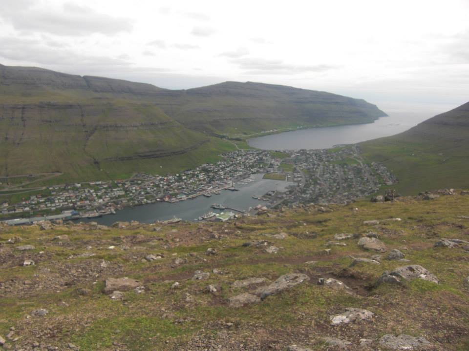
To the east, you overlook Haraldssund and the town of Klaksvík. Historically, Klaksvík consisted of four separate villages: Í Uppsølum, Í Gerðum, Á Myrkjanoyri, and Í Vági.
On your descent, you will see Halgafelli and Háfjall ahead. Across the fjord, Myrkjanoyrafjall and Kjølin (“The Keel”) rise prominently, the latter named for its resemblance to an upturned boat.
The hike ends at the same place where it began.
