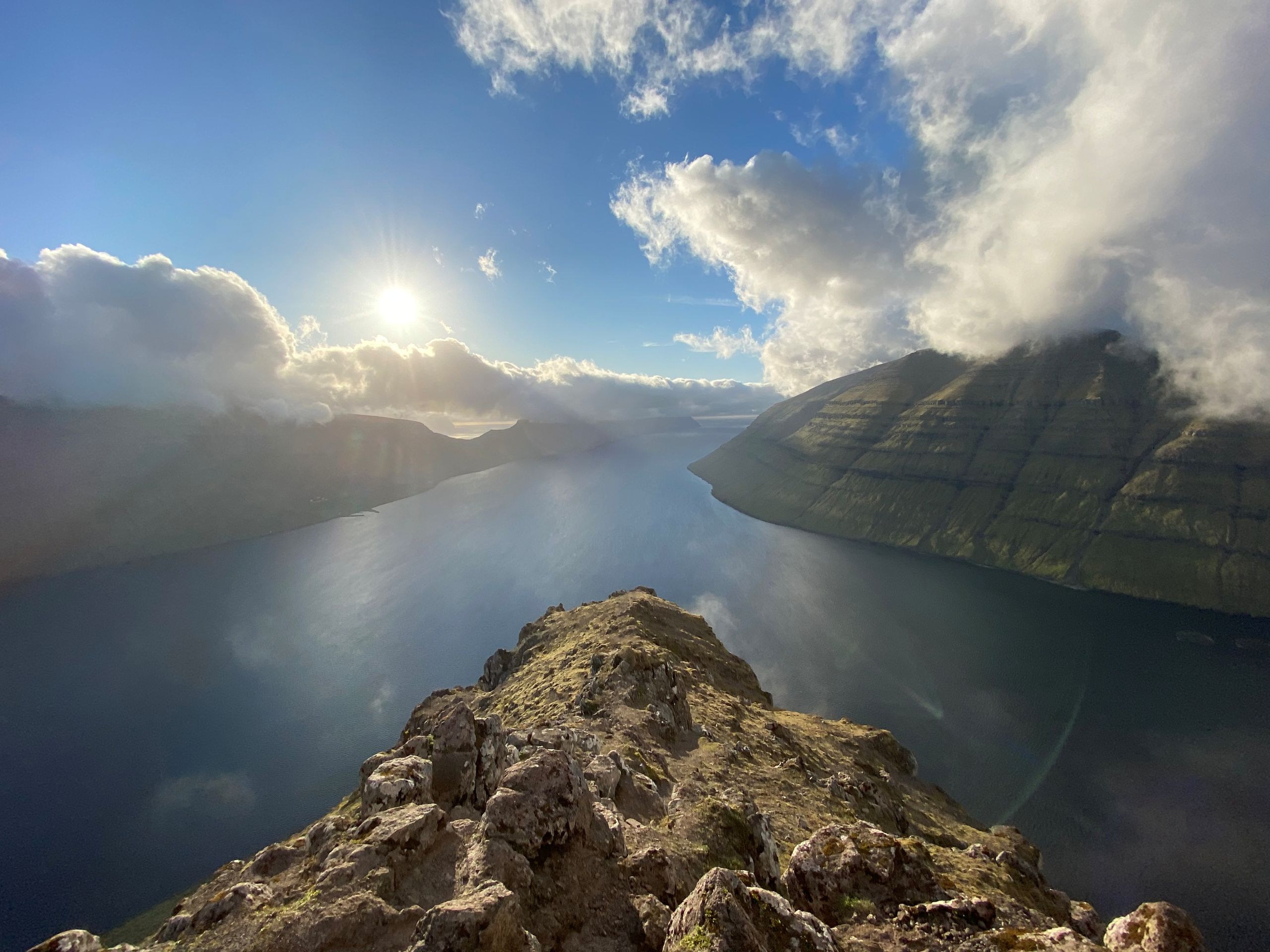
For detailed information, including a map and further insights into the hike, please visit:
https://whatson.fo/hiking/hike/klaksvik-klakkur?lang=en
There you will find everything you need to prepare for your hike and navigate the route with ease.
The hike to Klakkur is one of the most popular and accessible hikes in Klaksvík. It can be enjoyed year-round and rewards hikers with some of the most spectacular views in the Northern Isles.
The route begins in the centre of Klaksvík and gradually climbs toward the mountain ridge above the town.
Begin at the parking lot below the church in Klaksvík. Walk about 100–200 metres toward the roundabout. Turn right and continue 25–50 metres to Vágstún. From there, turn left and follow Uppsalagøta and then Nýggivegur for about 600 metres.
Turn right onto Oman Eið and continue for roughly 500 metres before reaching another roundabout. Follow Niðan Horn for about 400 metres. Then turn right onto a partially unpaved dirt road known locally as Ástarbreytin – The Love Path.
The gravel road continues up to Hálsur. It is also possible to drive up to this point and park there, although the road can be somewhat uneven.
From the outfield gate at Hálsur, head toward the highest point north of you. The path is not heavily marked, but it is easy to follow. A cairn visible ahead serves as a useful landmark.
The route passes through old peat fields. The ground is grassy almost all the way to the summit, with very few stones. In winter, this is even one of the rare places in the Faroe Islands where skiing is possible.
The area around Klakkur is rich in birdlife. Species often seen here include Oystercatcher, Arctic Skua, Snipe, Golden Plover, Whimbrel, and Lesser Black-backed Gull. Ravens are also common, and Rock Pipits can sometimes be spotted near the remains of old peat storage areas.
Just south of Hálsur lies a valley once called á Vaktini. According to local legend, people once kept watch here for hostile ships approaching the coast.
Looking west from the upper slopes, you can see Fagralíð. This is where Fólkaháskúlin (The Faroese Folk High School) originally stood after its founding in 1889, before it later moved to Tórshavn. It was here that the writer and poet Símun av Skarði wrote the Faroese national anthem “Tú alfagra land mítt” in 1906.
Take care when approaching the summit, as the cliffs become steep in places. The reward is an exceptional panoramic view.
To the west you can see Leirvík, Gøtunes, and Mjóvanes, and on clear days even the island of Nólsoy further south.
To the north lies Kalsoy, stretching across the sea like a long snake. The island was once nicknamed “The Flute” because of its many tunnels. Its villages are Syðradalur, Húsar, Mikladalur, and Trøllanes. Many visitors travel to Mikladalur to see the famous Seal Woman statue (Kópakonan).
To the east you’ll see Haraldssund, while Kunoy, the tallest island in the Faroe Islands, rises dramatically with six peaks above 800 metres.
Below you, Klaksvík spreads across the bay. The town originally consisted of four separate villages: Í Uppsølum, Í Gerðum, Á Myrkjanoyri, and Í Vági.
On your way down, you will see Halgafelli ahead and Háfjall further on. Across the fjord stands Myrkjanoyrafjall and the ridge Kjølin, named for its resemblance to the keel of an upturned boat.
The hike ends where it began, back in the centre of Klaksvík.

 9°C
9°C
